

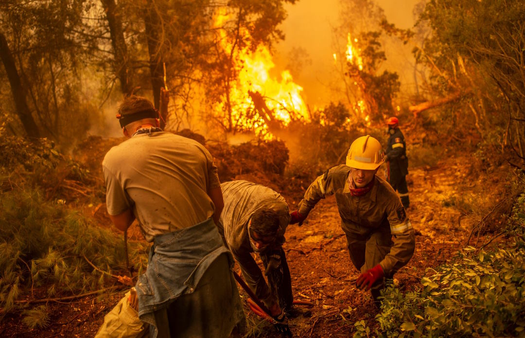
Introduction
ATAK-Civ (Android Team Awareness Kit for Civilian Use) is a versatile mobile application that enhances situational awareness, communication, and coordination for firefighters engaged in battling wildfires. This use case highlights how ATAK-Civ can significantly improve firefighter safety, equipment and asset tracking, and facilitate seamless cooperation and coordination among ground and aerial crews, as well as other emergency services such as police and EMS.
1. Situation Overview
During wildfires, effective coordination and communication among multiple response teams is critical. ATAK-Civ provides a comprehensive overview of the situation, including real-time fire spread information, weather conditions, and topographic data, enabling all responders to have a shared understanding of the situation.
2. Firefighter Safety
a. GPS Tracking: ATAK-Civ can track the real-time location of firefighters, enabling incident commanders to monitor their positions and ensure their safety. This feature allows for the rapid deployment of resources in case of emergencies, such as a firefighter becoming lost or injured.
b. Hazard Mapping: The application can display hazardous areas, such as intense fire activity zones, potential structural collapse areas, or hazardous material storage sites. Firefighters can access this information to avoid dangerous areas and make informed decisions to safeguard their safety.
c. Personal Safety Alerts: ATAK-Civ can send automated alerts to firefighters based on predefined criteria, such as sudden changes in fire behavior, approaching dangerous zones, or extreme weather conditions. These alerts help ensure that firefighters are promptly informed and can take appropriate action to protect themselves.
3. Equipment and Asset Tracking
a. Asset Identification: ATAK-Civ allows firefighters to tag and track essential equipment and assets, including fire engines, water tanks, tools, and supplies, using unique identifiers. This feature helps prevent loss, improves resource allocation, and enhances overall operational efficiency.
b. Real-time Equipment Status: Firefighters can update the status of equipment in the application, including fuel levels, maintenance requirements, and deployment information. Incident commanders can access this information to allocate resources efficiently and ensure that equipment is properly utilized.
4. Cooperation and Effort Coordination
a. Interagency Communication: ATAK-Civ provides secure communication channels for all responders, facilitating real-time information exchange and collaboration. Firefighters, police, EMS, and other emergency services can share critical updates, observations, and requests for assistance, fostering seamless cooperation and coordination.
b. Shared Mapping: The application enables all responders to share a common operational picture by displaying real-time mapping data. Ground and aerial crews can view each other’s positions and movements, improving coordination and reducing the risk of accidents or miscommunication.
c. Task Assignment: Incident commanders can use ATAK-Civ to assign specific tasks to ground and aerial crews based on their locations and capabilities. This feature ensures that resources are deployed effectively, optimizing firefighting efforts and minimizing response times.
d. Resource Tracking: ATAK-Civ allows incident commanders to monitor the availability and location of resources from multiple agencies, including fire engines, aircraft, police vehicles, and ambulances. This capability facilitates better coordination and resource sharing among different emergency services.
e. Emergency Service Integration: ATAK-Civ enables integration with other emergency service systems, such as police dispatch or EMS command centers. This integration enhances collaboration, enabling firefighters to request additional resources or coordinate joint operations seamlessly.
Conclusion
By leveraging the capabilities of ATAK-Civ, firefighters can significantly enhance their safety, improve equipment and asset tracking, and facilitate cooperation and coordination among ground and aerial crews and other emergency services. The application’s features, including real-time communication, shared mapping, task assignment, and resource tracking, enable efficient allocation of resources and real-time information sharing, leading to more effective firefighting efforts and enhanced safety for all responders involved in wildfire incidents. ATAK-Civ promotes a unified approach to firefighting, enabling seamless collaboration between ground and aerial crews, as well as with other emergency services such as police and EMS.
The integration of ATAK-Civ with police and EMS systems allows for effective cross-agency communication and coordination. Firefighters can request police assistance for traffic control or evacuation support, while EMS can receive real-time updates on the location and status of injured personnel. This interoperability enhances the overall response and ensures a coordinated effort among all emergency services.
During complex incidents, such as wildfires threatening urban areas, ATAK-Civ can facilitate the creation of shared incident objectives and tactics among multiple agencies. Incident commanders can establish common operating procedures, define evacuation zones, and coordinate response efforts to safeguard both lives and property.
ATAK-Civ’s capabilities also extend to resource management beyond firefighting equipment. For example, it can track the location and availability of emergency shelters, medical facilities, and other critical infrastructure. This information enables firefighters and emergency services to efficiently allocate resources and provide aid to affected communities.
Moreover, ATAK-Civ offers real-time weather updates, allowing responders to monitor changes in wind patterns, humidity, and temperature. This information assists in predicting fire behavior and making informed decisions regarding fire suppression strategies and evacuation plans. By integrating weather data into the application, ATAK-Civ becomes an essential tool for mitigating the risks associated with rapidly evolving wildfire conditions.
In conclusion, ATAK-Civ revolutionizes the way firefighters approach wildfire incidents by prioritizing safety, enhancing equipment and asset tracking, and promoting cooperation and coordination among ground and aerial crews, as well as with other emergency services. By leveraging its features, incident commanders can optimize resource allocation, share real-time information, and establish a unified response strategy, ultimately leading to more efficient and effective wildfire suppression efforts while ensuring the safety of responders and the public.